Impact and Stewardship
Library collections are dynamic living entities whose lifeblood is the user. The unique and culturally significant maps and atlases in the Clark Library play an indispensable role in meeting the research and teaching needs of our campus and broader communities. As stewards of the collection, Clark staff are responsible for acquiring, describing, preserving and providing access to maps and atlases. Research projects such as this further overall understanding of our collections, and add to the existing knowledge bank of Dutch cartographic publishing in the 17th century. We have already presented some of our findings and look forward to sharing more through subsequent presentations and scholarly communication.
Our new understanding of 17th century Dutch cartography made us aware of areas in which we could better enhance our collection by acquiring other important Dutch maps and atlases from this period. Serendipitously, during the course of this project a copy of Jodocus Hondius Jr.’s Appendix Atlas Maioris (1629) became available and we purchased it. This is a rare atlas that contains the maps from the plates that were sold to Willem Blaeu in 1630, a sale that sparked a bitter rivalry between publishing houses that would last into the 18th century (for more information about the feud, see the “A Cartographic Rivalry”). More recently we purchased a copy of one of the earliest atlases of the Netherlands, Germania Inferior (1617). The author of the atlas, Pieter van den Keere, was trained by his brother-in-law Jodocus Hondius Sr., and the maps greatly influenced the mapmakers in our study.
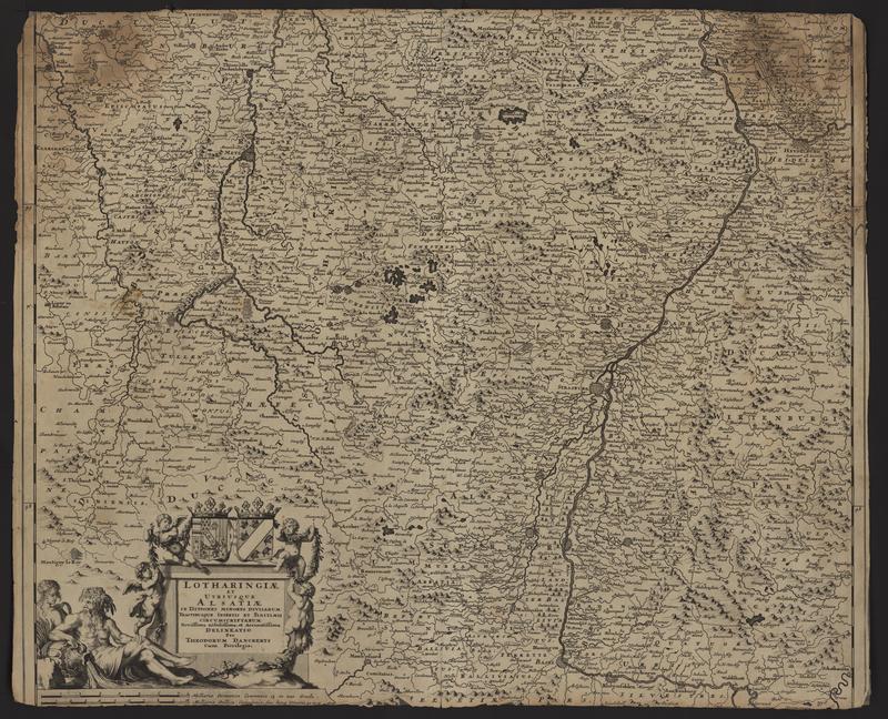
In an effort to preserve and make these maps more accessible to researchers and students we digitized the 188 maps in the project and made them available through the U-M Library’s Digital Collections’ “UM Clark Library Maps.” Since this project began we have have seen heavier use by local faculty and students, as well as from remote users, including the Dutch mapping expert Peter van der Krogt. Digitized versions are frequently used by faculty for class projects and by students for research papers and dissertations. High resolution images enable researchers to see details that are not as easily visible on the physical copy.
Orphan Maps
About This Exhibit