Sanborn Maps: Early Wayfinding through Mapping
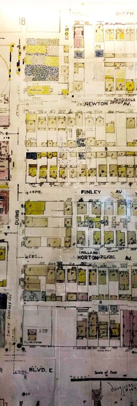
Featuring a portion of the Sanborn Company Maps which were produced beginning in 1867, this artwork features Poletown in Detroit, MI and features historic regional neighborhood development. It demonstrates the utility of detailed information about the built environment and echoes how we use computational data to aid wayfinding and proximity with tools we use every day today (for example, GPS, Google Maps).
The image above is a blueprint of homes and buildings. The smaller structures are shaded yellow or pink and larger structures are blue. The squares that represent buildings are displayed in a grid form.
This piece was created by visitors to the University of Michigan Detroit Center and participants in the African Presidential Scholars Program.
You can find the original inspiration for this piece in the Stephen S. Clark Library Map Oversize Collection.

The Anatomage: Synthesis of first and current medical illustrations

Hilye: Artistic interpretations of the Prophet Muhammad

