Carte Géométrique...
The Carte Géometrique des Environs de l'Estang de Longpendu, D'ont Leau Tombe dans l'Ocean et dans la Mediterranée, Comprenant Grand Part du Comte du Charolois (Charolais, France) was engraved by Jan van Damme, sieur d'Armendale, but it was included in atlases by Henricus Hondius, Johannes Janssonius, Joan Blaeu, and Melchoir Tavernier between 1631 and 1635. The map features the coat of arms of the Kingdom of France, which combines the coat of arms of France with that of the Kingdom of Navarre. Like many of the maps in the Vignaud Map Collection, the map features a manuscript "75" in the upper right corner of the verso.


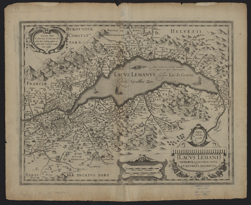
Lacus Lemani